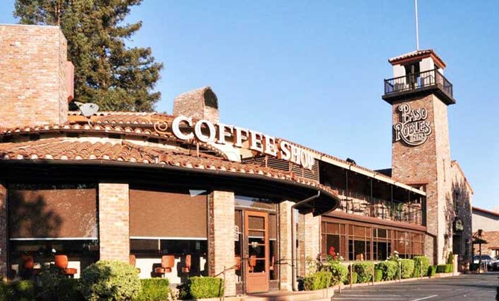
Homes, condos and land for sale and rent in Paso Robles, CA
Paso Robles is located on the Rancho Paso de Robles Mexican land grant that was purchased by James and Daniel Blackburn in 1857. The land was a rest-stop for travelers of the Camino Real trail, and was known for its mineral hot springs. In fact, Franciscan priests from neighboring Mission San Miguel constructed the first mineral baths in the area. During this period, Paso Robles began to attract the pioneer settlers who would become the founding members of the community. They would later establish cattle ranches, apple and almond orchards, dairy farms, and vineyards.
In 1864, the first El Paso de Robles Hotel was constructed and featured a hot mineral springs bath house. Today, only three locations (Paso Robles Inn, River Oaks Hot Springs, and Franklin Hot Springs) are left that offer the healing mineral bath hot spring experience which brought famous people like Ignacy Jan Paderewski to Paso Robles.
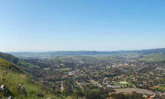
The topography of the area consists of gentle rolling hills on the eastern half of the city, and foothill peaks which rise in elevation to the Santa Lucia Coastal Range on the west, which are all blanketed in the Californian chaparral environment, which is mainly dry grassland and oak woodland. Simply “Paso,” as it is referred to by locals, sits on the eastern foothills of the Santa Lucia Coastal Mountain Range, which lies directly to the West of the city, and runs in a North-South direction, starting at Monterey, then runs down South to its terminus, in the San Luis Obispo area. The city is located at the southern end of the fertile Salinas River Valley, which is centered in between the Temblor Range (including the San Andreas Fault), which lie about 28 miles (45 km) to the East, and the Santa Lucia Coastal Range, which lie directly west, rising up from the city’s western border. Paso Robles sits at the border where northern San Luis Obispo County and southern Monterey County meet, and is situated roughly 24 miles (39 km), or 20 minutes, inland from the Pacific Ocean.
The Census reported that 29,624 people (99.4% of the population) lived in households, 164 (0.6%) lived in non-institutionalized group quarters, and 5 (0%) were institutionalized.
There were 10,833 households, out of which 4,104 (37.9%) had children under the age of 18 living in them, 5,721 (52.8%) were opposite-sex married couples living together, 1,345 (12.4%) had a female householder with no husband present, 603 (5.6%) had a male householder with no wife present. There were 767 (7.1%) unmarried opposite-sex partnerships, and 66 (0.6%) same-sex married couples or partnerships. 2,486 households (22.9%) were made up of individuals and 1,192 (11.0%) had someone living alone who was 65 years of age or older. The average household size was 2.73. There were 7,669 families (70.8% of all households); the average family size was 3.19.
The population was spread out with 7,829 people (26.3%) under the age of 18, 2,827 people (9.5%) aged 18 to 24, 7,870 people (26.4%) aged 25 to 44, 7,271 people (24.4%) aged 45 to 64, and 3,996 people (13.4%) who were 65 years of age or older. The median age was 35.3 years. For every 100 females there were 94.9 males. For every 100 females age 18 and over, there were 92.4 males.
There were 11,426 housing units at an average density of 588.2 per square mile (227.1/km²), of which 6,412 (59.2%) were owner-occupied, and 4,421 (40.8%) were occupied by renters. The homeowner vacancy rate was 1.9%; the rental vacancy rate was 3.8%. 16,666 people (55.9% of the population) lived in owner-occupied housing units and 12,958 people (43.5%) lived in rental housing units.
Other cities in San Luis Obispo County
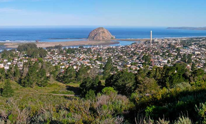
Morro Bay Real Estate for sale and rent
Homes, condos and land for sale and rent in Morro Bay, CA Morro Bay is a waterfront city in San Luis Obispo County, California. As of the 2010 census, the city population was 10,234, down [...]
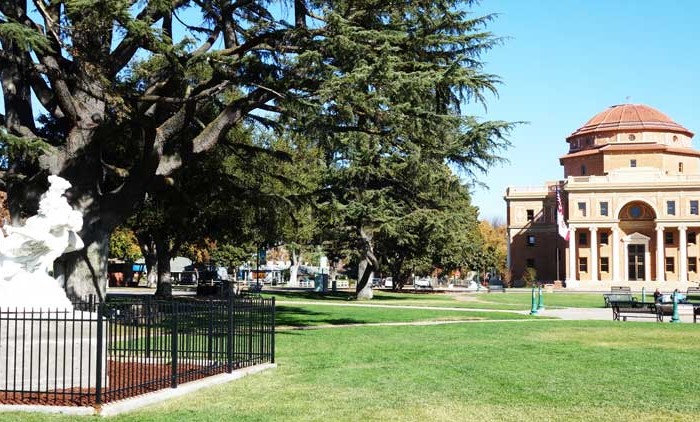
Atascadero Real Estate for sale and rent
Homes, condos and land for sale and rent in Atascadero, CA Atascadero is a city in San Luis Obispo County, California, about equidistant from Los Angeles and San Francisco on U.S. Route 101. Atascadero is [...]
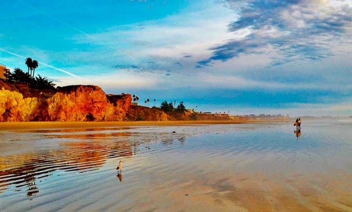
Pismo Beach Real Estate for sale and rent
Homes, condos and land for sale and rent in Pismo Beach, CA Pismo Beach is a city in San Luis Obispo County, in the Central Coast area of California, United States. The estimate population was [...]
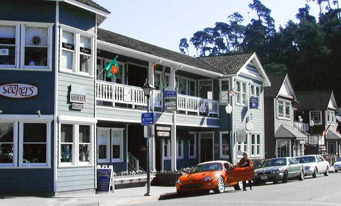
Cambria Real Estate for sale and rent
Homes, condos and land for sale and rent in Cambria, CA Cambria is a seaside village in San Luis Obispo County, California, United States midway between San Francisco and Los Angeles along California State Route [...]
Paso Robles Real Estate for sale and rent
Homes, condos and land for sale and rent in Paso Robles, CA Paso Robles (full name: El Paso de Robles 'The Pass of the Oaks') is a city in San Luis Obispo County, California, United [...]
San Luis Obispo Real Estate for sale and rent
Homes, condos and land for sale and rent in San Luis Obispo, CA San Luis Obispo or SLO for short, is a city in the U.S. state of California, located roughly midway between Los Angeles [...]
Nipomo Real Estate for sale and rent
Homes, condos and land for sale and rent in Nipomo, CA Nipomo is a census-designated place (CDP) in San Luis Obispo County, California, United States. The population was 12,626 at the 2000 census, and grew [...]
Arroyo Grande Real Estate for sale and rent
Homes, condos and land for sale and rent in Arroyo Grande, CA Chico is the most populous city in Butte County, California, United States. As of the 2010 United States Census, the population was 86,187, [...]