Homes, condos and land for sale and rent in San Mateo, CA
San Mateo was incorporated in 1894. By car, San Mateo is about thirty minutes from downtown San Jose and twenty-five minutes from downtown San Francisco.
In 1810 Coyote Point was an early recorded feature of San Mateo. Beginning in the 1850s, some wealthy San Franciscans began building summer or permanent homes in the milder mid-peninsula. While most of this early settlement occurred in adjacent Hillsborough and Burlingame, a number of historically important mansions and buildings were constructed in San Mateo.
According to the United States Census Bureau, the city has a total area of 15.9 square miles (41 km2), of which, 12.1 square miles (31 km2) is land and 3.8 square miles (9.8 km2) (23.63%) is water.
The best-known natural area is Coyote Point Park, a rock outcropped peninsula that juts out into the San Francisco Bay. The early Spanish navigators named it la punta de San Mateo. Crews of American cargo ships carrying grain in the bay renamed it Big Coyote (BLM, 1853). Sailors had a penchant for naming promontories at the edge of San Francisco Bay after the coyote; across the bay in Fremont are the Coyote Hills, part of Coyote Hills Regional Park. By the 1890s the shore area was developed as a popular beach called San Mateo Beach. In 1842 the Spanish had named it playa de San Mateo. Today Coyote Point is home to CuriOdyssey, formerly known as the Coyote Point Museum, a major natural history museums and wildlife centers in the state. The Peninsula Humane Society is also situated at Coyote Point.
Hispanic or Latino of any race were 25,815 persons (26.6%); 14.4% of San Mateo is Mexican, 2.8% Guatemalan, 2.6% Salvadoran, 1.2% Peruvian, 0.9% Nicaraguan, 0.5% Puerto Rican, 0.3% Colombian, 0.3% Chilean, 0.2% Honduran, and 0.2% Cuban.
The Census reported that 95,891 people (98.6% of the population) lived in households, 975 (1.0%) lived in non-institutionalized group quarters, and 341 (0.4%) were institutionalized.
There were 38,233 households, out of which 11,464 (30.0%) had children under the age of 18 living in them, 17,964 (47.0%) were opposite-sex married couples living together, 3,824 (10.0%) had a female householder with no husband present, 1,656 (4.3%) had a male householder with no wife present. There were 2,098 (5.5%) unmarried opposite-sex partnerships, and 343 (0.9%) same-sex married couples or partnerships. 11,751 households (30.7%) were made up of individuals and 4,391 (11.5%) had someone living alone who was 65 years of age or older. The average household size was 2.51. There were 23,444 families (61.3% of all households); the average family size was 3.14.
The population was spread out with 20,254 people (20.8%) under the age of 18, 6,915 people (7.1%) aged 18 to 24, 30,772 people (31.7%) aged 25 to 44, 25,286 people (26.0%) aged 45 to 64, and 13,980 people (14.4%) who were 65 years of age or older. The median age was 38.9 years. For every 100 females there were 95.4 males. For every 100 females age 18 and over, there were 92.8 males.
There were 40,014 housing units at an average density of 3,298.8 per square mile (1,273.7/km²), of which 19,969 (52.2%) were owner-occupied, and 18,264 (47.8%) were occupied by renters. The homeowner vacancy rate was 1.5%; the rental vacancy rate was 3.7%. Of the population, 50,951 people (52.4%) lived in owner-occupied housing units and 44,940 people (46.2%) lived in rental housing units.
The city is home to the College of San Mateo, a community college. The campus of over 10,000 students is located on 153 acres in the western foothills of the city which offer a panoramic view of the San Francisco Bay. Other universities in the area include Notre Dame de Namur University, a private Catholic university of 2,000 students in neighboring Belmont and Stanford University located about 12 miles to the south.
The San Mateo Union High School District also hosts an adult school behind the campus of San Mateo High School.
Other cities in San Mateo County
Pacifica Real Estate for sale and rent
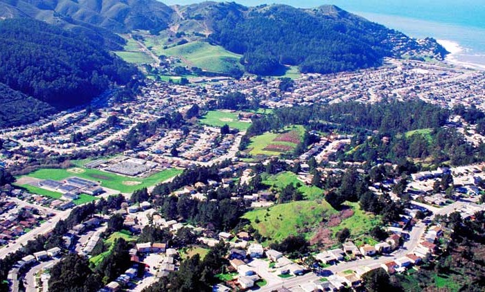
Homes, condos and land for sale and rent in Pacifica, CA Pacifica is a city in San Mateo County, California, on the coast of the Pacific Ocean between San Francisco and Half Moon Bay. The [...]
Menlo Park Real Estate for sale and rent
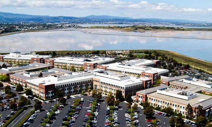
Homes, condos and land for sale and rent in Menlo Park, CA Menlo Park is a city at the eastern edge of San Mateo County, in the San Francisco Bay Area of California, in the [...]
Redwood City Real Estate for sale and rent
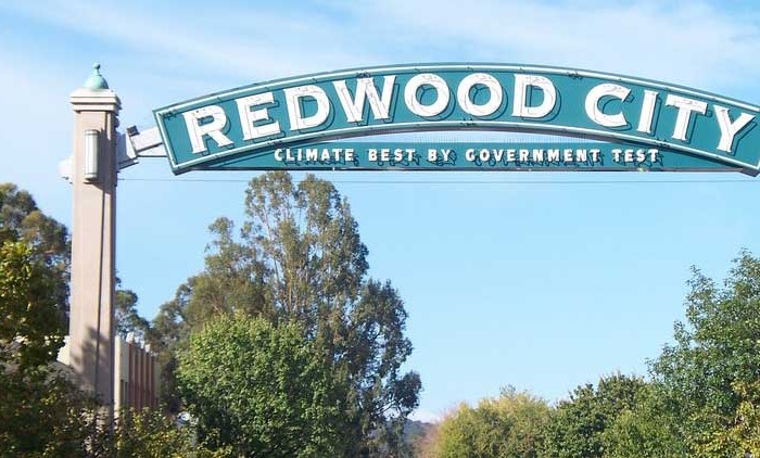
Homes, condos and land for sale and rent in Redwood City, CA Redwood City is a city on the San Francisco Peninsula in Northern California's Bay Area, approximately 27 miles (43 km) south of San [...]
San Mateo Real Estate for sale and rent
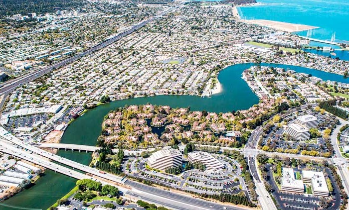
Homes, condos and land for sale and rent in San Mateo, CA San Mateo is a city in San Mateo County, California, in the high-tech enclave of Silicon Valley in the San Francisco Bay Area. [...]