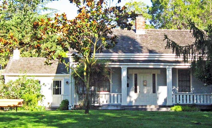
Homes, condos and land for sale and rent in Watsonville, CA
The Pajaro Valley, wherein Watsonville is located, has a climate that is usually pleasant — around 60 to 70 degrees Fahrenheit throughout the year. This climate makes Watsonville an attractive coastal environment for the neighboring inland communities with very hot summers. The Pajaro Valley Unified School District has an attendance of about 18,000 students kindergarten through 12th grades. There are several private religious-based schools in Watsonville such as Notre Dame School, Monte Vista Christian, Salesian Sisters and St. Francis. There are also several charter schools and the non-religious independent Pre-K through 12th grade Mount Madonna School. These schools provide a wide range of educational options for local families. Watsonville is generally conservative on the political spectrum and average in relationship to the neighboring communities of Salinas, Castroville, and Prunedale.
In 1847, the second wave of European explorers was presented to this land where they finally decided to settle. Forty of these explorers officially lived in the city and had animals and some crops. In 1848, the gold rush in the Sierra Mountains was an important event for the city because people began to buy land for the low price that it had, allowing them to acquire large acres of property where farming and ranching would be among the simple practices that would shape the economy of the city. In 1868, Watsonville was finally incorporated as a town in the Santa Cruz County and later became a charter in 1903 when it was named after Judge John Watson
Average annual rainfall is 22.42 inches, with measurable precipitation falling on an average of 61 days each year. The wettest year on record was 1983 with 48.35 inches and the driest year was 1976 with 10.66 inches. The most rainfall in one month was 15.99 inches in February 1998. The most rainfall in 24 hours was 5.93 inches on February 14, 2000.
According to the United States Census Bureau, the city has a total area of 6.8 square miles (18 km2), of which, 6.7 square miles (17 km2) of it is land and 0.1 square miles (0.26 km2) of it (1.42%) is water.
The Census reported that 50,671 people (99.0% of the population) lived in households, 322 (0.6%) lived in non-institutionalized group quarters, and 206 (0.4%) were institutionalized.
There were 13,528 households, out of which 7,130 (52.7%) had children under the age of 18 living in them, 7,231 (53.5%) were opposite-sex married couples living together, 2,375 (17.6%) had a female householder with no husband present, 903 (6.7%) had a male householder with no wife present. There were 890 (6.6%) unmarried opposite-sex partnerships, and 107 (0.8%) same-sex married couples or partnerships. 2,466 households (18.2%) were made up of individuals and 1,213 (9.0%) had someone living alone who was 65 years of age or older. The average household size was 3.75. There were 10,509 families (77.7% of all households); the average family size was 4.17.
The population was spread out with 16,111 people (31.5%) under the age of 18, 6,001 people (11.7%) aged 18 to 24, 14,834 people (29.0%) aged 25 to 44, 10,014 people (19.6%) aged 45 to 64, and 4,239 people (8.3%) who were 65 years of age or older. The median age was 29.2 years. For every 100 females there were 99.2 males. For every 100 females age 18 and over, there were 98.2 males.
There were 14,089 housing units at an average density of 2,077.0 per square mile (801.9/km²), of which 5,957 (44.0%) were owner-occupied, and 7,571 (56.0%) were occupied by renters. The homeowner vacancy rate was 1.9%; the rental vacancy rate was 2.5%. 21,365 people (41.7% of the population) lived in owner-occupied housing units and 29,306 people (57.2%) lived in rental housing units.
Other cities in Santa Cruz county
Scotts Valley Real Estate for sale and rent
Homes, condos and land for sale and rent in Scotts Valley, CA Scotts Valley is a small city between San Jose and Santa Cruz County, California, United States, about thirty miles (48 km) south of [...]
Watsonville Real Estate for sale and rent
Homes, condos and land for sale and rent in Watsonville, CA Watsonville is a city in Santa Cruz County, California, United States. The population was 51,199 according to the 2010 census. Located on the central [...]
Aptos Real Estate for sale and rent
Homes, condos and land for sale and rent in Aptos, CA Aptos is a census-designated place (CDP) in Santa Cruz County, California, United States. The population was 6,220 at the 2010 census. Aptos is bisected [...]
Santa Cruz Real Estate for sale and rent
Homes, condos and land for sale and rent in Santa Cruz, CA Santa Cruz is the county seat and largest city of Santa Cruz County, California. Situated on the northern edge of Monterey Bay, about [...]